
Kathi Unglert and Tanya Samman, Earth and Environmental Science co-editors

GPS constellation – expandable 24-slot configuration, as defined in the SPS performance standard. (Image courtesy of the U.S. Government)
My radio alarm clock turns itself on at 7 A.M., and I wake to tunes on my favourite station, transmitted straight to my bedroom via satellite. What a great start!
Satellite imagery can be used to forecast water availability in reservoirs and to monitor crop health, which help provide me with a warm shower and cereal for my breakfast. I’m off to a meeting in a different town this morning. Thanks to my GPS, a satellite-borne global positioning technology originally developed by the U.S. military but now freely available to everyone, I easily find my way. During the meeting, we plan the upcoming broadcast of a science experiment from the International Space Station to local schools. The connection is – you guessed it – set up via satellite.
Satellites affect our daily lives in many ways. In the Earth and Environmental Sciences, satellite data facilitate valuable insights into large-scale issues such as environmental changes, marine pollution, algal blooms, and land use changes. From space, we can monitor erosion, detect gas emissions from volcanoes, and observe atmospheric conditions. Satellite data are used in defense & security, disaster management, fisheries, oil & gas, mining, agritech, and tourism.
The very first satellite was Sputnik 1, launched by the Soviet Union in 1957. Since then, many different countries have launched broadcasting, meteorological, communications, navigation, and Earth observation (EO) satellites into space. Canada currently operates two EO satellites: RADARSAT-2, for remote sensing and mapping applications; and SCISAT, for monitoring the condition of the ozone layer. The Canadian Space Agency has also recently put out a call for CubeSat missions.
CubeSats represent one of the newer developments in satellite technology. These satellites are cubic, with side lengths of approximately 10 cm, and are capable of many EO and other missions, thanks to miniature technology like that found in smartphones. They are small and relatively cheap, and are often sent into orbit in swarms, as combining them allows them to handle more complicated missions.
The number of satellites in orbit has increased dramatically over the last decade.
Because of decreasing cost and the development of new technologies like CubeSats, the number of satellites in orbit has increased dramatically over the last decade or so. In January 2017, more than 4000 satellites orbited the Earth. What is the advantage of having so many satellites in orbit? A massive volume of different types of data! High-repeat, low-resolution satellites in geostationary orbits collect multiple daily images to monitor meteorological patterns, making weather forecasts more accurate. High-resolution data reveal fine details, like those in Google Earth and in GIS applications. Some satellite data can be accessed freely, which opens up new possibilities for data analysis and development of applications.
Proper calibration of the satellite sensors is key, though, and without it mistakes can be made. Processing such a large volume of satellite data is challenging, so how do we harness this “data tsunami”? Experts do as much as they can, but more and more we rely on machines to help us process and analyze all the information we receive.
Only just over a quarter of satellites in orbit are operational.
Although this proliferation of satellites is a boon for gathering data, it has a down side. Satellites have a limited life span and eventually become space junk; only just over a quarter of satellites in orbit are operational. Collisions with disused parts represent a real danger for operational equipment and also for future spaceflight.
Five United Nations treaties regulate issues such as liability in case of damage caused by human-built objects in space, and can – but don’t have to – be ratified by member states. Furthermore, the UN has drafted five principles to guide member states on national legislation. These treaties and principles will need to be updated regularly to keep up to date with technological developments, and could be expanded to include preventative action, rather than reaction. For example, space-law experts suggest that future legislation might need to require limiting launches or de-orbiting satellites sooner, rather than merely regulating responsibility in case of damages.
So, while satellites help us explore space, learn more about the Earth, and improve our daily lives, they also come with challenges. What do we do about the overpopulation of Earth orbit satellites, both dead and active? How do we deal with the inherent danger of space debris to other satellites and future space missions? How do we come together globally to agree on a policy for how to manage satellite-related liabilities?
With increasing numbers of satellite technology applications and more people wanting to enjoy their benefits, it will take time for humanity to act on these issues.
–30–
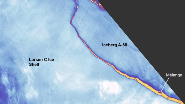
Featured image: Landsat spots birth of Iceberg A-68, Antarctica. Image acquired July 12, 2017. (Landsat imagery courtesy of NASA Goddard Space Flight Center and U.S. Geological Survey)