
By Mary Anne Schoenhardt, Science and Society co-editor
What’s the first thing that comes to mind when you think of maps? An old, rolled up piece of paper? An app on your phone? A piece of cultural identity?
A map is a symbolic representation of selected characteristics of a place, usually drawn on a flat surface. A map is both a tool and form of communication. Every story we tell and everything we do has a location associated with it. Data can be mapped, and stories can be told through maps.
The most important thing is that a map is a representation. In his book, How to Lie with Maps, geography professor Mark Monmonier explains that in order to represent three dimensional geography in two dimensions, you need to distort reality. What is included in a map, as well as what is left out, is up to the map maker, and is thus influenced by their priorities and the tools available to them. Renowned geographer and cartographer (a technical name for a map maker) Norman J.W. Thrower, in his book Maps and Civilization, says that “the map is a snapshot representing a phenomena at a given time.” In other words, maps act as a window into the period in which they were made.
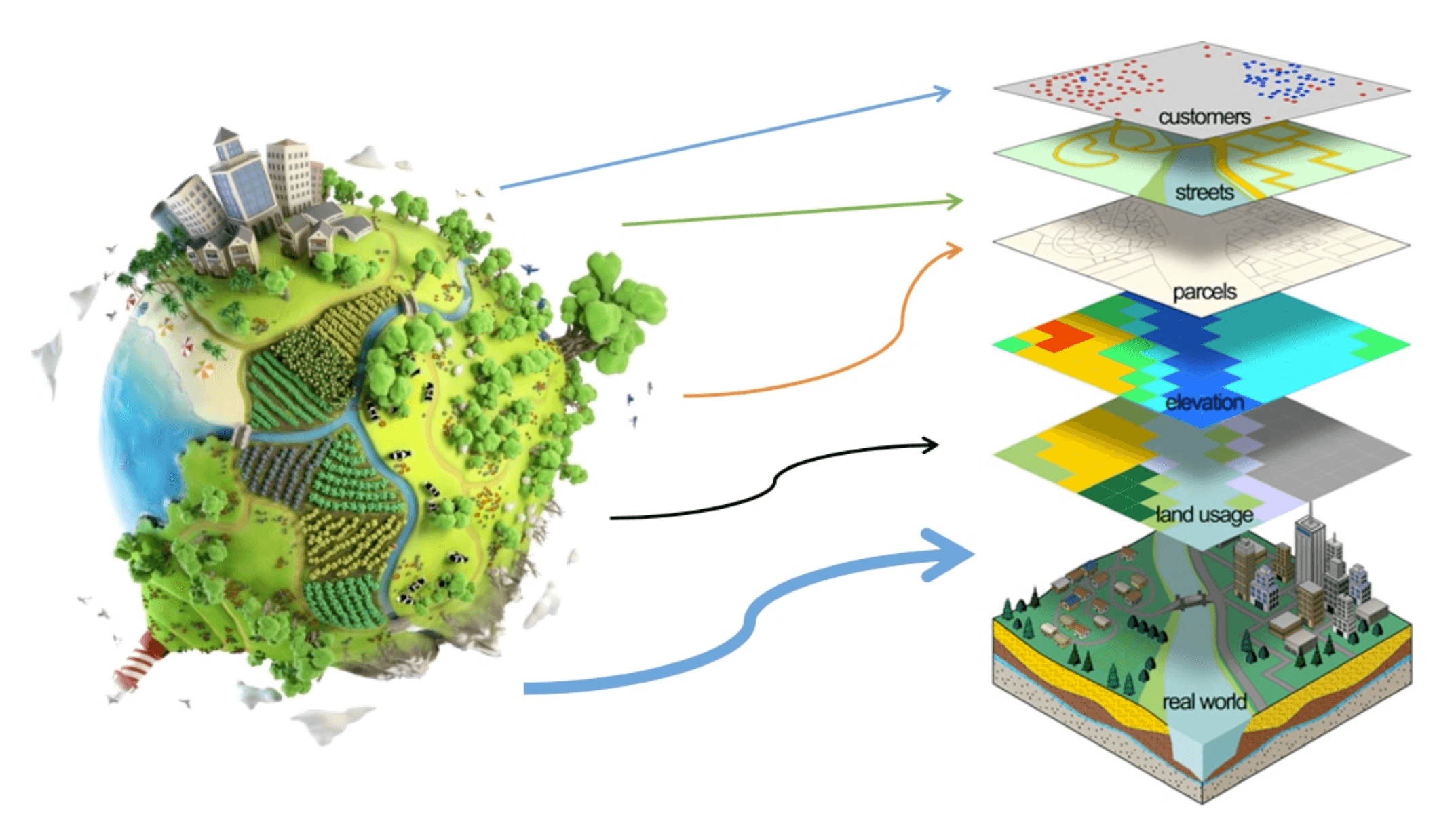
A map is a collection of data from a three-dimensional surface displayed in two-dimensions. What is included in the map is at the discretion of the cartographer and is dependent on availability of data and the purpose of the map. Schematic by the Pedometry Laboratory of the Federal Technological University of Paraná (CC BY-NC-SA 4.0).
Indigenous Understandings of the Land
Maps have been a critical part of Canadian society throughout history. Prior to European exploration and colonization, map making was a well-developed art among Indigenous peoples. While maps were occasionally drawn on bark or skins, it was more common for them to be sketched into the ground or snow. These maps were produced entirely from memory and accompanied by a detailed verbal description of the landscape. They were used for almost all aspects of daily life, including navigation, hunting, storytelling, and warfare.
Indigenous maps were incredibly accurate, especially when depicting shorelines. Instead of distance-based scales that are typically used in modern mapmaking, the scale was frequently based on a day’s journey, thus varying by terrain. Details were added to emphasize an area’s importance, but only when absolutely necessary. While the production of these maps entirely from memory may seem like an incredibly challenging task, being able to read the land was a skill that Indigenous people developed from childhood. An understanding of the landscape was (and continues to be) critical to the survival and culture of Indigenous groups across Canada.
Maps from Colonization and the Fur Trade
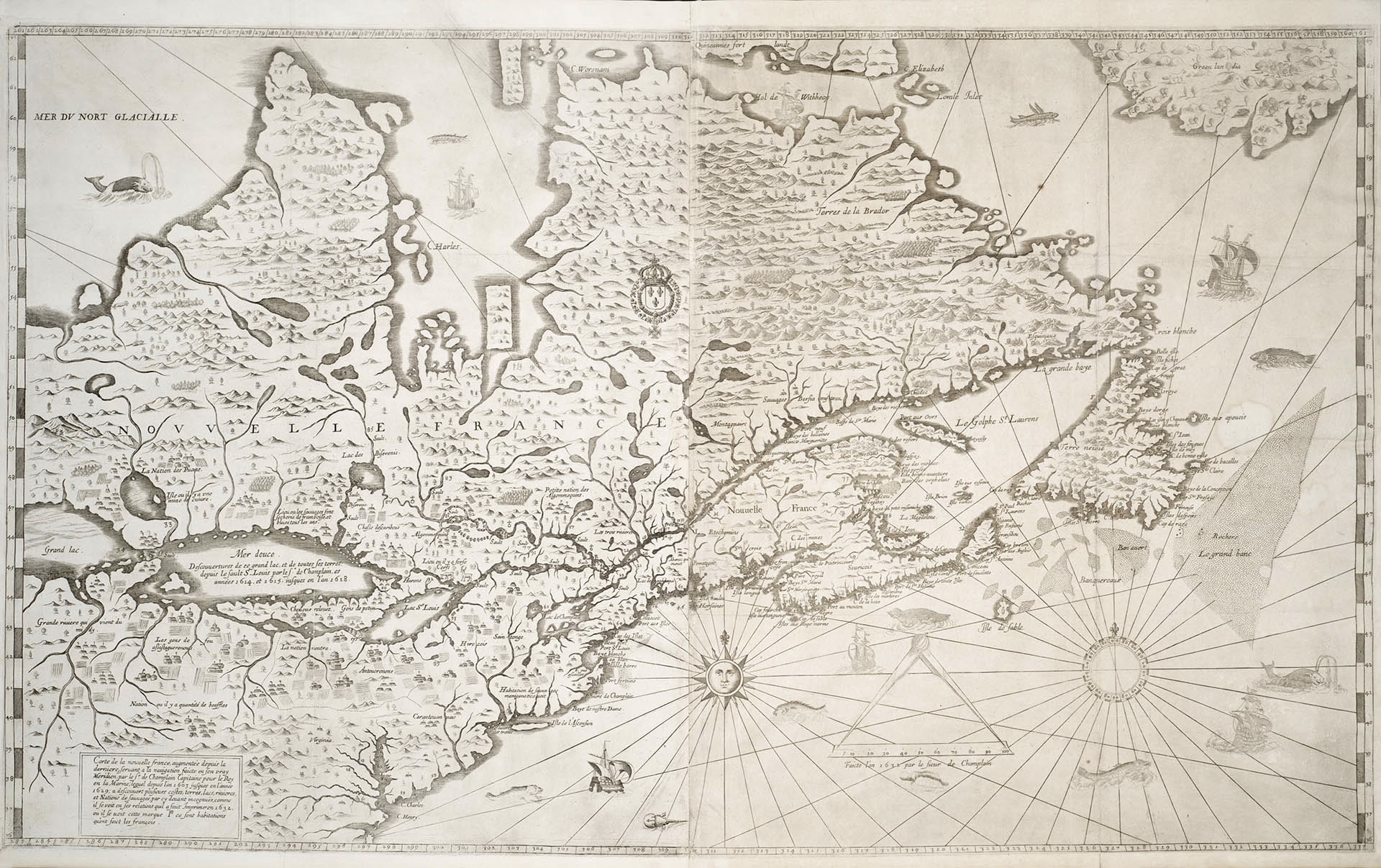
Samuel de Champlain’s 1632 map of Canada. Image: public domain.
Samuel de Champlain’s 1632 map of Canada (Public domain).A new era of map mapping started when Europeans first came to Canada, but the importance of Indigenous knowledge of the land didn’t diminish. Early French explorers relied heavily on Indigenous guides to lead them through unfamiliar lands. One of the earliest recorded maps of Canada was created by Samuel de Champlain in 1632. In his book The History of Canada in 10 Maps, historian, geographer, and modern-day explorer Adam Shoalts describes Champlain as holding Indigenous peoples in high regard, taking time to learn their languages and culture. He goes on to say that “[Champlain’s] map of New France was the result of 25 years of collaborative exploration with First Nations and his Coureurs de Bois”, and that “[Champlain’s] legacy is perhaps most fully told in the maps he left behind – maps many consider to be among the greatest ever made by any single explorer.”
Between the 16th and 19th centuries, map making remained essential to the development and colonization of what was to become Canada. “In an era when geographical knowledge was limited, maps were essential to empire – after all, you couldn’t very well claim to rule a place you can’t find on a map,” describes Shoalts. In addition to the growth of European empires in North America, much of the geographic information about Canada came from the fur trade and the goal of finding a route to the Pacific. The fundamental economy of trade was critical to the production of maps and geographic knowledge.
As Europeans, and later Canadians, ventured further and further inland, no one anticipated the true size of North America’s landmass. It was not until 1793 that Alexander Mackenzie found a route to the Pacific. Having travelled through Great Slave Lake and reaching the Arctic Ocean the year prior, Shoalts refers to Mackenzie as another of Canada’s greatest map makers. Like many of the men in the fur trade, Mackenzie had significant respect for the Indigenous peoples of Canada. “Anyone who couldn’t simply wouldn’t survive long in an environment where cooperation and respect from aboriginal colleagues was vital” Shoalts says. Like Champlain’s map, the knowledge obtained from Mackenzie’s voyage to western Canada likely would not exist without Indigenous peoples.
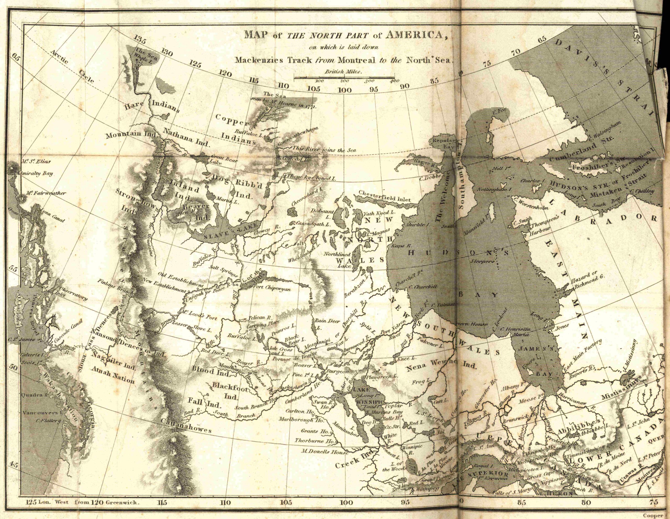
A map of Canada, as it was known following Alexander Mackenzie’s voyages to the Arctic and Pacific Oceans. A dotted line representing these trips can be seen starting in Montreal. Image: Manitoba Historical Maps (CC BY 2.0).
Modern Day Mapping
As with many other technologies, warfare acted as a significant catalyst in the development of mapmaking. Fast forwarding to the twentieth century, World Wars I and II revolutionized the way we collect and produce geographic information. Cameras mounted on planes for reconnaissance during WWI helped develop the science of photogrammetry, which uses aerial imagery to make reliable measurements. Following WWII, many soldiers returned from Europe with training in photogrammetry and contributed heavily to the topographic mapping of Canada.
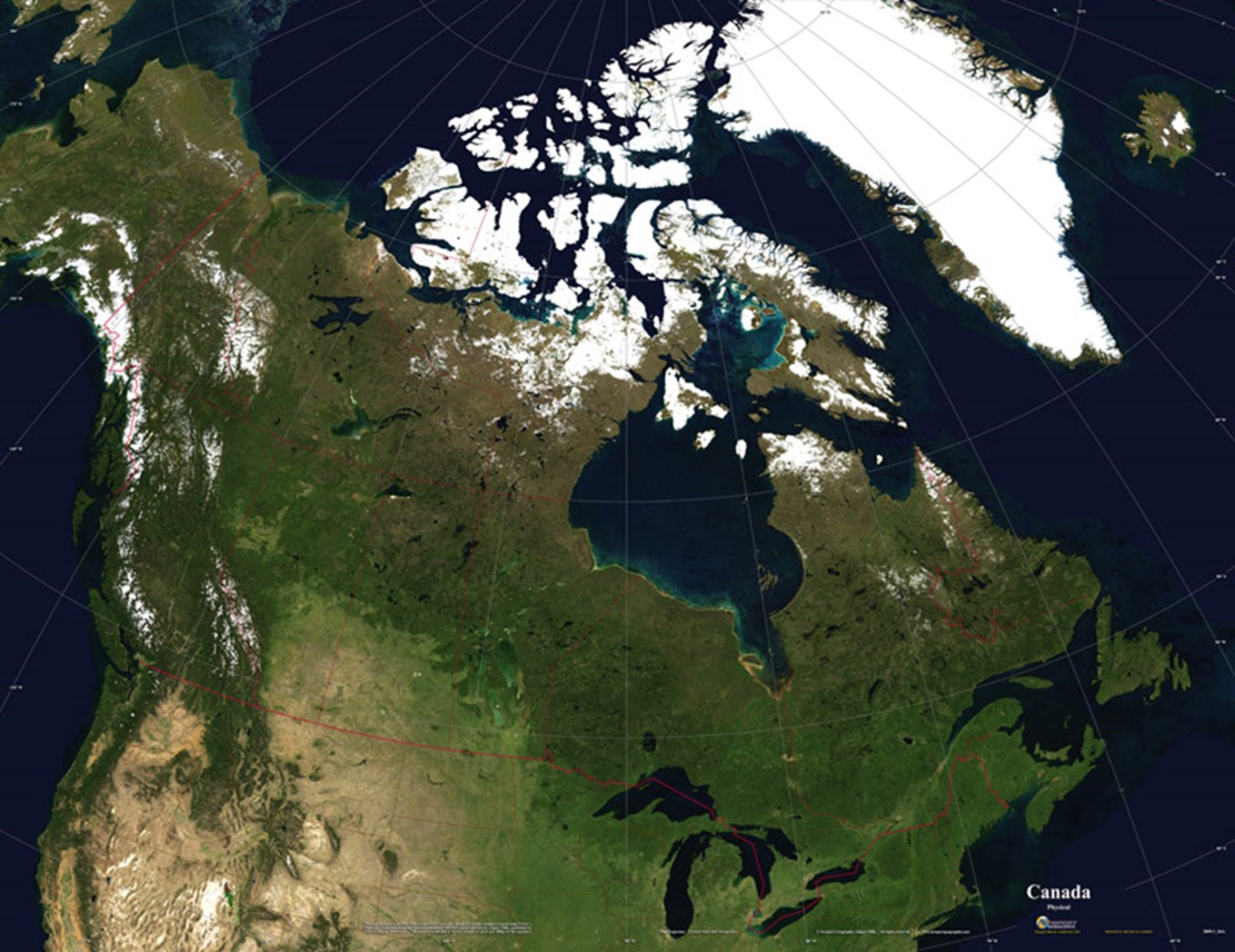
Satellites allowed for maps to be created at spatial scales unimaginable to early cartographers. Photo: Newport Geographic (CC BY 2.0).
Satellites allowed for maps to be created at spatial scales unimaginable to early cartographers. Photo from Newport Geographic (CC BY 2.0).In Maps and Civilization, Thrower says that “the use of aerial photographs beginning in the first half of the twentieth century has wrought changes in cartography comparable perhaps only to the effect of printing in the Renaissance or the use of satellites and the computer in the second half of the twentieth century”. This quote alludes to two more developments in map making and geographic knowledge – satellites and computers. Mapping was one of the very early applications of computers and technology, producing geographic knowledge on spatial and temporal scales unimaginable to the earlier explorers of Canada.
While a strong understanding of the landscape may not be as commonplace as it once was, maps are no less crucial to Canadian society. Geographic information is used more than ever before; indeed, mapping has been named one of the most important industries of the 21st century. The earliest maps were stories; cartographers were artists that used the knowledge, memories, and fears of travellers to tell these stories. Maps today are no different – they tell stories of data, with 80% of all data estimated to have a geographic attributes associated with it. Maps help governments assess the needs of their citizens and address these needs where they are most needed. Among other applications, maps are used in customer service, land-use planning, marketing, real estate, telecommunications, and health. It’s hard to think of a sector where maps aren’t used.
Maps and society are inextricably linked. From early Indigenous peoples of Canada, to colonization, to modern day, maps have played a crucial role in the development of the Canada we know today. Maybe next time you look at Google Maps, you’ll have a greater appreciation for the not-so-humble map!
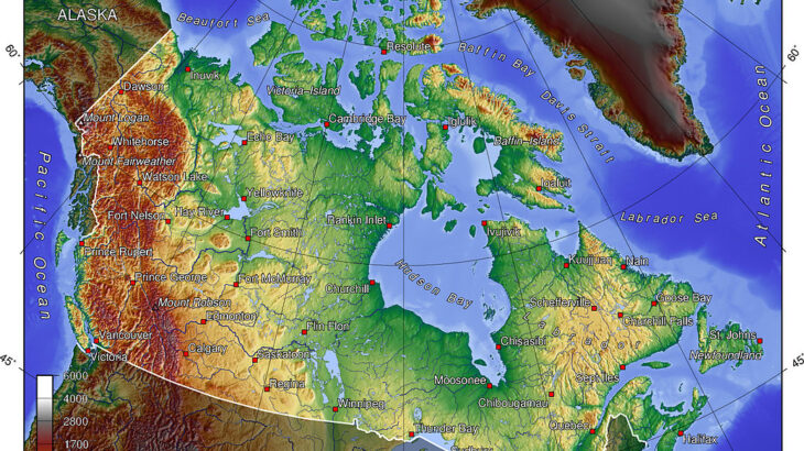
Banner image: Canada topo – Wikipedia (CC BY-SA 3.0).
