
By Qiaochu Liang, Biology & Life Sciences co-editor
The beaver is a familiar sight to Canadians. Castor canadensis is an official symbol of Canada and appears on many government-related artifacts including the Canadian nickel and the Parks Canada logo. But what do we really know about these amazing creatures? Today, advances in Artificial Intelligence (AI) are opening new doors to understanding these enigmatic builders, transforming how researchers study and monitor their movements and habitats.
A beaver primer
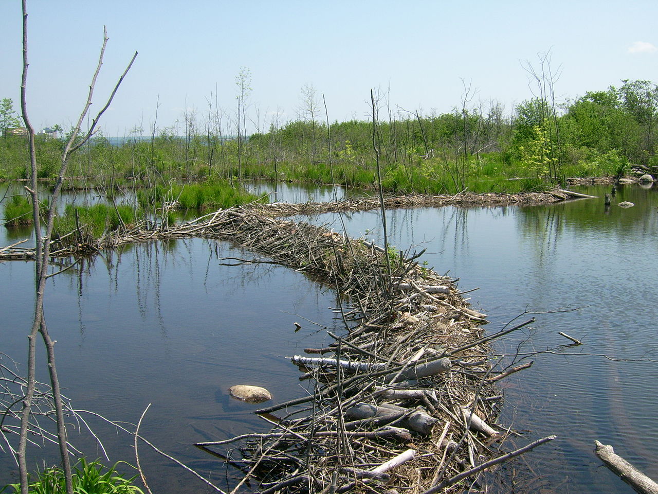
Beaver dams in St. Marys River, Sault Ste. Marie, Canada. Image: Wikimedia Commons.
Beavers are remarkably adaptable and are found in every province and territory, making them the most widespread mammal in the country. They live in a wide range of climates and environments across Canada, from the northern reaches of the Arctic to the southern border with the United States. Beavers thrive in forested areas with sufficient water resources, such as the boreal forest.
These environments offer the ideal conditions for beavers to build their dams and lodges. Dams are constructed to create deep, calm water where beavers can build their lodges. Lodges serve as their homes, places to store food for the winter, and safe havens from predators.
Beavers engage in dispersal migration, a journey that takes them from their birthplaces to seek new territories and partners. These migrations can vary from a few kilometres to hundreds of kilometres along large river systems.
How beaver ponds change the natural environment
Beavers are Nature’s engineers, and their knack for building dams not only enriches ecosystems but turns out to be a secret weapon against wildfires. These construction projects result in vast ponds that slow down the flow of water, allowing it to seep into the ground. This process not only promotes the growth of deep-rooted vegetation and creates a thriving wildlife habitat but also forms natural firebreaks that reduce wildfire spread. As climate change intensifies, leading to more frequent fires and droughts, the contributions of beavers to our ecosystems become increasingly vital.
In this video, Dr. Emily Fairfax, a beaver researcher at the University of Minnesota shows how beaver dams act as natural barriers against the spread of wildfires.
The double-edged impact of beavers in a warming world
This story of ecological heroism unfolds within a broader, more intricate narrative of environmental change and adaptation. As our planet’s climate changes, beavers are extending their territory northward into the Arctic. This migration is the consequence of a substantial increase in beaver numbers due to reduced trapping and the favourable new habitat to be found further north due to climate change.
Beaver activities are transforming Arctic ecosystems in profound ways. The construction of beaver ponds in these virgin territories exacerbates warming by thawing permafrost, leading to the release of methane—a greenhouse gas—with a significant impact on global warming. This dramatic alteration of the landscape also poses challenges to indigenous communities, disrupting their traditional hunting and fishing practices, and affecting water quality.
Where’s Beaver?
Communities, scientists, and conservationists across Canada are engaged in a delicate dance of leveraging the environmental benefits that beavers offer while also addressing the complex challenges brought about by their expanding range. To fully understand the dual nature of beavers’ impact—both beneficial and challenging—a comprehensive, large-scale study is needed.
The sheer scope of beaver habitats poses a big challenge. The quest to track the elusive paths of beavers as they navigate and transform vast landscapes often demands significant resources and efforts. Traditionally, this meant scientists had to undertake rigorous expeditions, trekking through dense forests, navigating marshy wetlands, or paddling along winding streams to locate and analyze the structures of beaver-engineered landscapes. Such fieldwork, filled with logistical hurdles, often required researchers to carry heavy equipment over challenging terrain, making these studies both physically demanding and time-consuming.
The advent of aerial photography and, later, satellite imagery, marked a significant shift in how these studies were conducted. These technologies allow researchers to study the effects of beavers from above, offering a comprehensive view without setting foot in these hard-to-reach areas. High-resolution satellite images enable them to scan large expanses of land from their computers, searching for the distinctive shapes and shadows indicative of beaver dams.
Despite being less physically demanding and more efficient than fieldwork, this approach still requires a sharp eye and immense patience. The work is transformed into a meticulous task, with trained professionals dedicating numerous hours to distinguishing the signs of beaver activity from other natural features. As Dr. Emily Fairfax attests, “I’d pull down these satellite images and then comb through them like I’m doing a Where’s Waldo for hours and hours.”
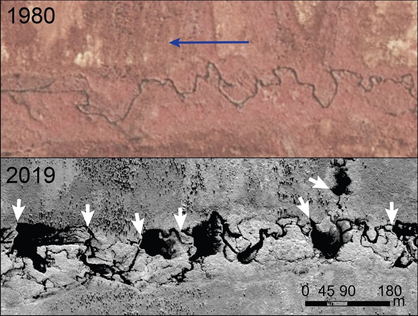
This image pair shows the evolution of the riverine environment due to beaver activity. An aerial image from 1980 (top) shows a tundra stream on Alaska’s Seward Peninsula flowing in the direction of the blue arrow. A satellite image from 2019 (bottom) shows how beaver dams (white arrows) turned the stream into a chain of ponds. Image: Tape et al. (2022), CC BY 4.0.
Unveiling beaver habitats with Artificial Intelligence (AI)
Recognizing the need for automated approaches for identifying beaver dams and habitats more quickly and accurately, scientists have recently harnessed advances in AI, opening an exciting new chapter in beaver research.
A machine learning model called the Earth Engine Automated Geospatial Elements Recognition (EEAGER) was developed through a collaboration between Google engineers, beaver researchers, and conservationists to detect beaver dams from aerial and satellite imagery. By training this intelligent algorithm on diverse images of beaver dams across various landscapes, scientists have endowed EEAGER with the ability to efficiently scan large areas, pointing out beaver dams accurately and tirelessly.
EEAGER’s capabilities extend beyond mere identification; it facilitates ongoing monitoring of beaver activity and their environmental impact. For instance, EEAGER can process historical images, enabling researchers to observe shifts in beaver populations over time—especially useful as climate change expands their potential range. This capability makes EEAGER instrumental in pinpointing significant shifts in beaver-affected areas, such as Alaska and northern Canada, where there has been a notable increase in populations. By automating the tedious task of mapping beaver habitats, researchers can now spend more time analyzing data and crafting strategies to protect and manage these industrious creatures for the health of our planet.
Like any machine learning model, the accuracy of EEAGER is dependent on the diversity and quality of the training data it is fed. Initially, the model achieved an accuracy of 98.5% in locating beaver dams in imaged landscapes, with a notably stronger performance in regions used to train the model. However, the model’s current input data are limited, focusing on areas with beaver dams and not capturing the full range of beaver habitats, like those without dams or in large rivers and lakes where beavers behave differently. This data gap can lead the model to overpredict the presence of beavers in certain terrains but miss beaver activity in others. Additionally, the model’s performance varies when faced with previously unseen imagery, occasionally mistaking unrelated features for beaver dams. EEAGER’s accuracy can be improved by incorporating more diverse input data from various ecosystems.
Mapping the future
Beavers are remarkable creatures with a profound impact on their environments, capable of both creating and transforming ecosystems. With the advent of new tools like EEAGER, scientists are now better equipped to identify beaver habitats and monitor their expansion across diverse landscapes. This innovative application of AI not only enhances our understanding of beaver ecology but also showcases EEAGER as a promising tool for broader ecological monitoring. It heralds the potential of similar AI applications in environmental science for monitoring other complex landforms across large regions.
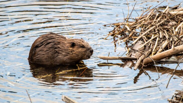
Feature image: A North American beaver beside its dam. Image: GlacierNPS from Flickr.
